April 06, 2023
Salt segmentation from subsurface seismic data can be quite challenging and time-consuming, even for an experienced human interpreter. Salt bodies and their surrounding sediments frequently may act as traps for hydrocarbons, making salt imaging a vital part of the hydrocarbon extraction process.
A recent advancement in exploration geophysics is to leverage digitalization by machine learning for seismic processing, imaging, and interpretation. In this article, we showcase how Convolutional Neural Networks (CNN) can act as a powerful tool to accurately classify salt bodies and their surrounding sediments.
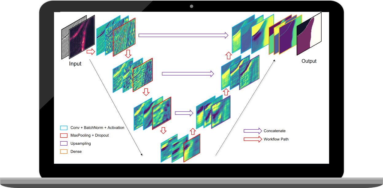
The objective of this project is to identify salt bodies and compare the different evaluation metrics to systematically analyze the influence of different seismic attributes on salt segmentation. We designed a multi-channel UNet-and residual net combined architecture for predicting salt bodies. UNet is effectively used when the size of output is similar as input with some amount of spatial resolution. This also helps in creating the segmentation mask and image processing.
Figure 1 shows the architecture of feature maps extracted after each convolutional layer. The preliminary inputs for the model have been decided as the seismic amplitude data and binary mask labels with two labels - 0 (non-salt body) and 1 (salt body). To improve the model performance, two additional attributes are introduced to the workflow: saliency map and contour. The saliency map attribute has been calculated by two methods – OpenCV with spectral residual approach and Vanilla Integrated Gradient approach, and the contour feature helps to understand the clear boundary of the salt body.
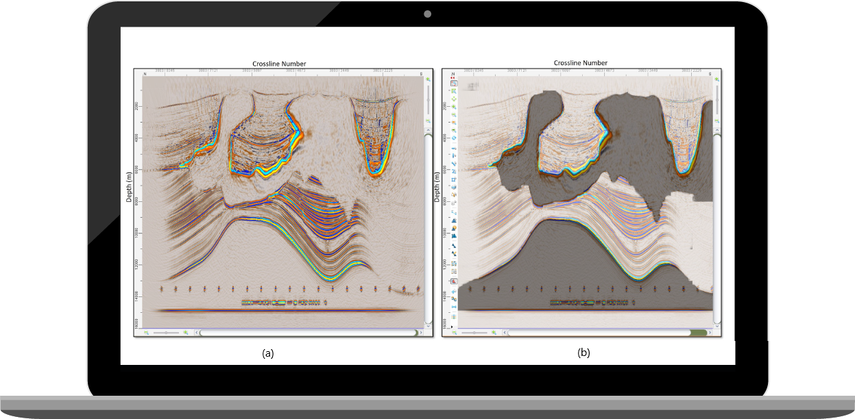
In this model, the types of training data have been redesigned as three settings: seismic only, a hybrid of seismic plus saliency, and a hybrid of seismic plus contour. Figure 2 shows the prediction result from the trained model where test data has been created by combining the seismic and saliency attributes.
The whole comparison has been based on the calculated IOU metrics and losses for each approach. A table (1) has been prepared to show the results for a better understanding.
| Types | IOU Metrics | Losses |
|---|---|---|
| Metrics Without Saliency | 0.867 | 0.11 |
| Metrics Saliency using Vanilla Gradient Model | 0.874 | 0.105 |
| Metrics Saliency Using OpenCV | 0.96 | 0.02 |
| Metrics with application of contour on the seismic data | 0.95 | 0.03 |
The deep learning algorithm has been evaluated thoroughly with different evaluation metrics and loss calculations. Two different strategies have been implemented and comparisons are made based on their performance. The first strategy is with the binary label. The IOU metrics were calculated. The second strategy is incorporating various attributes as additional input channels. This showed a promising result and enhanced the model's performance with a stable training process.
To conclude, the practical strategies with U-Net based deep learning algorithm show a higher accuracy and robustness in salt boundary detection and have a promising application in ML (Machine Learning) assisted seismic interpretation.
Are you exploring ways to leverage machine learning and AI to optimize your subsurface workflows?